
Drone Mapping, Rising Water Temperature and Reduced Industrial Pollution: New Focus on Scientific Protection of the Ganga
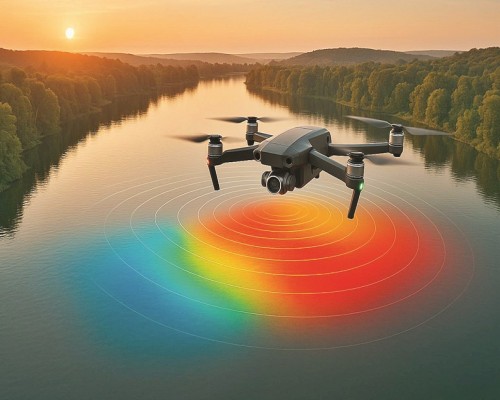
A major technology-driven effort has been initiated to strengthen the monitoring, conservation and ecological protection of the River Ganga from Gangotri to Gangasagar. Under the National Mission for Clean Ganga, all natural and human-made drains falling into the river will be identified, monitored and mapped through drone-based technology. The initiative comes at a time when scientific studies are also warning that rising water temperature in the Gangetic region may pose a serious threat to the river’s ecosystem, aquatic life and agriculture-dependent communities.
The National Mission for Clean Ganga has approved the Standard Operating Procedure for a drone-based survey and monitoring system. Under this project, the entire drainage network spread along both banks of the Ganga will be surveyed through drones. The objective is to digitally identify every drain, stream and water channel that meets the river so that pollution sources can be monitored with greater accuracy.
According to the approved plan, a GIS-based web application and a drain decision support system will be developed after aerial surveys and video mapping. Through this system, any drain can be digitally tracked from its original source to the point where it merges with the Ganga. This will help authorities understand which drains are carrying clean water, which are discharging sewage or industrial waste, and which areas require urgent intervention.
In Uttar Pradesh, nearly 2,200 square kilometres of area has been identified for this survey. During the exercise, all small and large drains, water streams and water bodies falling within a 200-metre range on both sides of the river will be mapped using high-resolution 2D and 3D data. The purpose is to create a precise and scientific record of pollution sources and drainage pathways connected with the Ganga.
The National Mission for Clean Ganga has also directed the state missions of Uttarakhand, Bihar, Jharkhand and West Bengal to implement the same Standard Operating Procedure immediately. Once the drone survey is completed, the states will share the collected data with the National Mission for Clean Ganga. The information will then be linked to a centralised database through a coded system. This will make real-time monitoring of drains falling into the Ganga possible and provide a stronger digital base for river conservation planning.
A key feature of this system will be the unique identification of every drain. Each drain falling into the Ganga will be geo-tagged and given a specific identification code. Through this, the location, route, discharge pattern and pollution-related details of each drain will be available at a single click. Technical standards have already been set under the approved procedure to ensure uniformity in data collection and monitoring.
While technological monitoring is being strengthened, scientific studies have also drawn attention to the growing threat of rising water temperature in the Ganga. Research by IIT Hyderabad and other international institutions indicates that the average temperature of Ganga water in the main flow region may rise by around 1.88°C by the year 2090. Such a rise could disturb the river’s ecological balance and directly affect aquatic biodiversity, water quality, agriculture and communities dependent on the river.
Experts have warned that warmer river water reduces dissolved oxygen levels. Scientific estimates mentioned in the report suggest that a rise of 1°C in water temperature can reduce oxygen levels by nearly 2.3 percent. This is a serious concern because dissolved oxygen is essential for fish, aquatic plants, microorganisms and the overall health of the river ecosystem.
The warning is significant because the Ganga already faces pressure from pollution, reduced natural flow, untreated sewage, industrial discharge and climate-related changes. A rise in water temperature may worsen these existing problems. If the trend continues, the river could face more frequent ecological stress, including conditions similar to what scientists describe as “riverine heatwaves” or periods when river water remains unusually warm for several days.
The impact may not remain limited to aquatic life. According to the study, warmer Ganga water could also affect irrigation, agriculture, drinking water availability and livestock-dependent activities. The warning becomes even more serious because a large population across the Gangetic plains depends directly or indirectly on the river.
Scientists have suggested that the solution lies in increasing green cover along riverbanks, protecting natural water flow, reducing pollution and restoring traditional water bodies. Special attention is needed to maintain environmental flow in the river, prevent the discharge of untreated sewage and industrial waste, and reduce activities that increase thermal and chemical stress in the river system.
At the same time, official data under the Namami Gange programme shows that industrial pollution entering the Ganga has declined significantly since 2017. The pollution load measured through Biological Oxygen Demand from highly polluting industries has reportedly reduced by around 60 percent. The BOD load from highly polluting industries has come down from nearly 26 tonnes per day in 2017 to around 10.75 tonnes per day in 2024.
Authorities linked with the Namami Gange programme have attributed this reduction to several regulatory and monitoring measures introduced over the years. The Central Pollution Control Board currently operates 112 water quality monitoring stations along the main stream of the Ganga across Uttarakhand, Uttar Pradesh, Bihar, Jharkhand and West Bengal. These stations help track water quality and monitor pollution trends across the river basin.
The decline in industrial pollution is an important development, but experts believe that the challenge of restoring the Ganga remains complex. Industrial pollution is only one part of the problem. Untreated sewage, solid waste, encroachment, reduced flow, riverbank degradation and climate change continue to affect the river’s health. Therefore, the new drone-based drain mapping project is expected to provide a more complete and scientific understanding of the pollution entering the river.
The combined picture emerging from these developments is clear: the Ganga conservation effort is moving towards a more data-based and technology-supported model, but climate-related threats require equal attention. Reduction in industrial pollution shows that regulatory action can deliver results. However, rising water temperature and the continuing inflow of polluted drains show that long-term protection of the river will require continuous monitoring, strict enforcement and ecological restoration.
The drone mapping project can become a major tool in identifying the real sources of pollution and ensuring accountability. If each drain is digitally tracked, geo-tagged and monitored, it will become difficult for untreated sewage or waste discharge to remain hidden. The system may also help policymakers decide where sewage treatment plants, interception projects, riverfront restoration measures and enforcement actions are most urgently needed.
The Ganga is not merely a river system; it is closely linked with India’s culture, agriculture, economy, environment and public health. Protecting it requires a balance between modern technology, scientific research, strict pollution control and community participation. The latest initiatives and studies indicate that the coming years will be crucial for the river’s future.
A cleaner and healthier Ganga will depend not only on reducing visible pollution but also on addressing hidden and long-term threats such as rising water temperature, declining oxygen levels and ecological stress. Drone surveys, water quality monitoring, industrial regulation and climate-sensitive river management together can provide a stronger path for restoring the river from Gangotri to Gangasagar.